
The event Geosites in My Local Area had an excellent turnout in Puerto Bertrand and Chile Chico between November 27 and 30. Residents, community leaders, school representatives, and members of the tourism sector were among the participants who attended the final round of talks from the Chelenko Geopark Project—an initiative led by geologist Manuel Suárez Dittus, who has traveled throughout the General Carrera Province over the past year.
The activity aimed to directly share the geological heritage of the Chile Chico commune. It included a theoretical session focused on the geological formations of the General Carrera Province, complemented by the evolutionary history of Aysén. After the lecture portion, participants took part in a field visit to geologically significant sites, both socially and scientifically.
The Chelenko Geopark Project is a CORFO Public Good initiative, funded by the Regional Government, mandated by the Undersecretariat of Mining, and executed by the Regional Museum of Aysén. The training sessions were designed to strengthen local tourism narratives and empower the community with knowledge of their geological heritage. As the educational component is fundamental to the project, the activities in Puerto Bertrand were tailored to the specific needs of local tourism service providers. Together with residents, the project team visited Lake El Plomo and the source of the Baker River, following the questions and hypotheses posed by the participants.
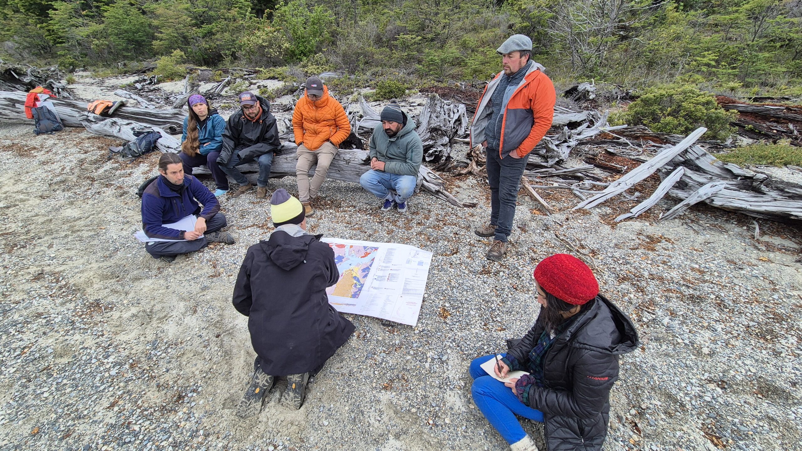
For Mauricio Otárola, a member of the Committee on Entrepreneurship and Tourism of Puerto Bertrand, the activity was highly enriching, complementing the work they do daily. He adds that after participating in the event, “we’re now seeing all of Patagonia with different eye» how Patagonia was formed, the types of rocks it contains. So, it’s of great value. The professor taught us a lot and, as I said, we see Patagonia, or Puerto Bertrand, the place where we work as tour guides, with different eyes. And the rocks also have their own stories and speak for themselves. They’re beautiful rocks—each one looks like a small planet lying in the water,” says Otárola.
Meanwhile, the event held in Chile Chico focused on highlighting lesser-known geosites that are essential to understanding the history and evolutionary development of the municipal capital. The itinerary began at the Jeinimeni River paleodelta, continued through the Fénix erratic block, and ended at the Ligorio Márquez coal mine, a site where remains of paleoflora have been found.
This field activity provided a unique opportunity to identify the local morphology. Patricia Sarabia, acting director of the Chile Chico Primary School, shared her perspective: “I think this type of initiative is wonderful. It invites us to learn about places that are characteristic of our area, but with an emphasis on history and origins. It helps us feel a greater sense of belonging. I believe this kind of activity must be repeated. I hope they come back to our town, and that more people can take part in this experience.”
In this way, this approach to sharing geological heritage is a necessary step in fostering a sense of connection and ownership over this localized knowledge. Geologist Manuel Suárez Dittus, who concluded his participation in the Chelenko Geopark Project with this event, explained, “Knowing what we have is tremendously important in order to protect it. This project is part of a knowledge chain that began with the recognition of what exists here, what the geological history of the area is, and the identification of key sites of interest. These places need to be shared in a special way, cared for, and given a narrative for visitors—something that makes visits to the region more engaging.”
As the initiative prepares to enter its final phase, Juan Vásquez Alarcón, Regional Mining Secretary (Seremi de Minería), believes the results clearly demonstrate the relevance of the project, which must now focus on bringing together institutions and private actors to build a governance framework.
“This event, which combined theory with fieldwork at local geosites, was very successful because it brought together diverse local stakeholders and strengthened the appreciation of the province’s geological heritage. The success of this activity lays the foundation for establishing the governance of the geopark, a key component to consolidating this project as a driver of sustainable development in the General Carrera Province. Governance will include local, regional, and national actors and will be responsible for defining strategies for managing the geopark, promoting economic, social, and educational benefits that positively impact communities.”
As previously mentioned, the project will soon enter its final execution phase, focusing on building a governance structure and action plan to shape the future vision of the geopark. This effort will continue to engage with the communities that form part of the geopark through ongoing collaboration and outreach.